Wereld
Noord-Amerika
- Canada
- VS
- Alaska en Hawaï
- Midden-Westen
- Noordoosten
- West
- » Arizona
- ⇓ Californië
-
- Adelanto
- Agoura Hills
- Alameda
- Alamo
- Alhambra
- Aliso Viejo
- Alliance
- Alpine
- Altadena
- Alturas
- Anaheim
- Anderson
- Antelope
- Antioch
- Apple Valley
- Aptos
- Arcadia
- Arcata
- Arnold
- Arroyo Grande
- Arvin
- Atascadero
- Atherton
- Atwater
- Atwater
- Auburn
- Auburn
- Avalon
- Avenal
- Azusa
- Bakersfield
- Baldwin Park
- Banning
- Barons Agcm
- Barstow
- Bassano
- Beiseker Agcm
- Bell
- Bellflower
- Belmont
- Belvedere Tiburon
- Benicia
- Berkeley
- Beverly Hills
- Big Bear
- Big Bear Lake
- Big Valley Agcm
- Bishop
- Blairsden-Graeagl
- Bloomington
- Blue Canyon
- Blythe
- Blythe
- Bonita
- Boron
- Boulder Creek
- Brandon
- Brantford
- Brawley
- Brea
- Brentwood
- Buena Park
- Bullhorn Coulee Reservoir
- Burbank
- Burlingame
- Byron
- Cadogan Agcm
- Calabasas
- Calexico
- Calgary Int'l Cs
- California City
- Camarillo
- Camino
- Campbell
- Campo
- Canoga Park
- Canyon Country
- Capistrano Beach
- Cardiff-by-the-Sea
- Carlsbad
- Carmel-by-the-Sea
- Carmel Valley
- Carmichael
- Carnelian Bay
- Carpinteria
- Carson
- Castaic
- Castro Valley
- Cathedral
- Cerritos
- Charles M. Schulz
- Chatsworth
- Chico
- Chico
- Chino
- Chino Hills
- Chowchilla
- Chula Vista
- Churchill Climate
- Churchill Falls
- Citrus Heights
- Claremont
- Clearlake
- Clearlake Oaks
- Cloverdale
- Clovis
- Coachella
- Coalinga
- Colfax
- Collinsville
- Colton
- Columbia
- Compton
- Concord
- Corcoran
- Corning
- Corona
- Corona
- Corona del Mar
- Coronado
- Corte Madera
- Costa Mesa
- Cottonwood
- Covina
- Craigmyle
- Crescent City
- Crestline
- Crestomere
- Culver
- Cupertino
- Cypress
- Daly
- Dana Point
- Danville
- Davis
- Davis
- Death Valley National Park
- Delano
- Delburne
- Delhi
- Del Mar
- Desert Hot Springs
- Dewberry
- Diamond Bar
- Dinuba
- Discovery Island
- Dixon
- Downey
- Downtown Los Angeles
- Duarte
- Earlimart
- Edwards
- Edwards
- Edwards
- El Cajon
- El Centro
- El Centro
- El Cerrito
- El Dorado Hills
- Elk Grove
- El Mirage
- El Monte
- El Segundo
- El Sobrante
- Emeryville
- Encinitas
- Encino
- Escalon
- Escondido
- Estevan
- Etzikom
- Eureka
- Eureka
- Fairfax
- Fairfield
- Fair Oaks
- Fallbrook
- Fallbrook
- Felton
- Fillmore
- Folsom
- Fontana
- Foothill Ranch
- Forestburg
- Foresthill
- Fort Bragg
- Fort Frances
- Fort Irwin National Training Center
- Fort Irwin National Training Center
- Fort Macleod
- Fort Mcmurray
- Fortuna
- Fortuna
- Fountain Valley
- Frazier Park
- Fremont
- Fresno
- Fullerton
- Fullerton
- Galt
- Gardena
- Garden Grove
- Gilroy
- Gilt Edge North Agcm
- Glendora
- Glenevis
- Goleta
- Granada Hills
- Grand Terrace
- Granite Bay
- Grass Valley
- Grass Valley
- Grates Cove
- Great Falls Climate
- Greenbrae
- Greenfield
- Gridley
- Grover Beach
- Gustine
- Hacienda Heights
- Half Moon Bay
- Half Moon Bay
- Hanford
- Harbor City
- Hawaiian Gardens
- Hawthorne
- Hawthorne
- Hayward
- Hayward
- Healdsburg
- Hemaruka Agcm
- Hemet
- Hercules
- Hermosa Beach
- Hesperia
- Highland
- Hollister
- Hollister
- Holtville
- Hoopa
- Hughenden Agcm
- Huntington Beach
- Huntington Park
- Imperial
- Imperial Beach
- Imperial Beach
- Indio
- Inyokern
- Ione
- Irvine
- Irvine
- Jean Cote Agcm
- Jofegan
- Kelowna Ubco
- Kessler Agcm
- King City
- Kingsburg
- Kitscoty
- La Cañada Flintridge
- La Crescenta-Montrose
- La Crete Agcm
- Lafayette
- La Glace Agcm
- La Grande Iv
- Laguna Beach
- Laguna Hills
- Laguna Niguel
- La Habra
- La Jolla
- Lake Arrowhead
- Lake Elsinore
- Lake Forest
- Lake Hughes
- Lake Isabella
- Lake Los Angeles
- Lakeport
- Lakeside
- Lake Superior Provincial
- Lakewood
- La Mirada
- Lamont
- Lancaster
- La Palma
- La Puente
- La Quinta
- Larkspur
- Lathrop
- La Verne
- La Verne
- Lawndale
- Legal Agcm
- Lemon Grove
- Lemoore
- Lemoore
- Lincoln
- Linden Agcm
- Lindsay
- Littlerock
- Live Oak
- Livermore
- Livermore
- Livingston
- Lodi
- Loma Linda
- Lomita
- Lompoc AFB
- Lompoc Airport
- Long Beach
- Loomis
- Los Alamitos
- Los Altos
- Los Angeles
- Los Banos
- Los Gatos
- Los Osos
- Lovelock
- Lucerne Valley
- Lynwood
- Madera
- Magalia
- Malibu
- Mammoth Lakes
- Mammoth Lakes
- Manhattan Beach
- Mannville
- Manteca
- Marina
- Marina del Rey
- Mariposa
- Marticot Island
- Martinez
- Marysville
- Marysville
- Marysville AF
- Matagami
- Maywood
- McFarland
- Mckinleyville
- Meadow Lake
- Mecca
- Menifee
- Menlo Park
- Mentone
- Merced
- Merced
- Middletown
- Millbrae
- Mill Valley
- Milpitas
- Mira Loma
- Miramar
- Mission Hills
- Mission Viejo
- Modesto
- Modesto
- Moffett Field
- Mojave
- Montague
- Montclair
- Montebello
- Monterey
- Monterey
- Monterey Park
- Moorpark
- Moraga
- Moreno Valley
- Moreno Valley
- Morgan Hill
- Morro Bay
- Mossleigh
- Mountain View
- Mount Wilson
- Murrieta
- Murrieta Hot Springs
- Myrnam Agcm
- Napa
- Napa
- National
- Naval Air Weapons Station China Lake
- Needles
- Needles
- Nevada City
- Newbury Park
- Newhall
- Newport Beach
- Newport Coast
- New Sarepta
- Nipomo
- Norco
- North Highlands
- North Hills
- North Hollywood
- North Island
- Northridge
- Norwalk
- Novato
- Novato
- Nuevo
- Oakdale
- Oakland
- Oakley
- Oak Park
- Oceano
- Oceanside
- Oceanside
- Ojai
- Olivehurst
- Ontario
- Ontario
- Orange Cove
- Orangevale
- Orinda
- Orosi
- Oroville
- Oxnard
- Oxnard
- Oxnard Luchthaven
- Pacifica
- Pacific Palisades
- Pacoima
- Pakowki Lake Agcm
- Palmdale
- Palm Desert
- Palm Springs
- Palm Springs
- Palo Alto
- Palo Alto
- Palos Verdes Peninsula
- Panorama
- Paradise
- Paramount
- Parlier
- Pasadena
- Paso Robles
- Paso Robles
- Patterson
- Pekisko
- Penn Valley
- Perris
- Petaluma
- Petaluma
- Phelan
- Pico Rivera
- Pine Valley
- Pinole
- Pioneer
- Pismo Beach
- Pittsburg
- Placentia
- Placerville
- Placerville
- Playa del Rey
- Pleasant Hill
- Pleasanton
- Pollock Pines
- Pomona
- Porter Ranch
- Porterville
- Port Hueneme
- Portola Valley
- Poway
- Prince George Luchthaven
- Quesnel Airport Auto
- Quincy
- Ramona
- Rancho Cordova
- Rancho Cordova
- Rancho Cucamonga
- Rancho Mirage
- Rancho Palos Verdes
- Rancho Santa Fe
- Rancho Santa Margarita
- Red Bluff
- Redding
- Redlands
- Redondo Beach
- Redwood City
- Redwood Valley
- Reedley
- Reseda
- Revelstoke
- Rialto
- Ribstone
- Ridgecrest
- Rio Linda
- Ripon
- Riverbank
- Riverside
- Riverside
- Rocklin
- Rohnert Park
- Rosamond
- Rosemead
- Roseville
- Rowland Heights
- Running Springs
- Sacramento
- Sacramento
- Saglek Bay
- Saint-michel-des-saints
- Salinas
- San Anselmo
- San Bernardino
- San Bernardino
- San Bruno
- San Carlos
- San Carlos
- San Clemente
- San Clemente
- Sandberg
- San Diego
- San Diego AP/B
- San Diego AP/M
- San Diego/Gil.
- San Dimas
- San Fernando
- San Fernando
- San Francisco
- San Gabriel
- Sanger
- Sanirajak
- San Jacinto
- San Jose
- San Jose/Reid
- San Juan Capistra
- San Leandro
- San Lorenzo
- San Luis Obispo
- San Marcos
- San Mateo
- San Nicolas
- San Pablo
- San Pedro
- San Quentin State Prison
- San Rafael
- Santa Ana
- Santa Barbara
- Santa Barbara
- Santa Catalina
- Santa Clara
- Santa Clarita
- Santa Cruz
- Santa Fe Springs
- Santa Margarita
- Santa Maria
- Santa Monica
- Santa Monica
- Santa Paula
- Santa Rosa
- Santa Ynez
- Santee
- San Ysidro
- Saratoga
- Sausalito
- Savanna Agcm
- Scotts Valley
- Seal Beach
- Seaside
- Sebastopol
- Selma
- Shafter
- Shasta
- Shasta Lake
- Sherman Oaks
- Shingle Springs
- Shonts Agcm
- Sidney
- Sierra Madre
- Simi Valley
- Sloughhouse
- Solana Beach
- Soledad
- Solvang
- Somerset
- Sonoma
- Sonora
- South El Monte
- South Gate
- South Lake Tahoe
- South Pasadena
- South San Francisco
- Spring Valley
- Stanford
- Stanton
- Stephenville
- Stevenson Ranch
- St. John's
- St. Lina
- Stockton
- Studio
- Suisun
- Sun City
- Sunland-Tujunga
- Sunland-Tujunga
- Sunnyvale
- Sun Valley
- Susanville
- Susanville
- Sylmar
- Taft
- Tahoe City
- Tarzana
- Tawatinaw
- Teepee Creek
- Tehachapi
- Tehachapi
- Temecula
- Temple
- The Pas
- Thermal
- Thorsby Agcm
- Thousand Oaks
- Thousand Palms
- Thunder Bay Superior West
- Torrance
- Trabuco Canyon
- Tracy
- Trinity Center
- TROIS-RIVIERES
- Trona
- Truckee
- Tulare
- Tulelake
- Turlock
- Tustin
- Twentynine Palms
- Ukiah
- Union City
- Upland
- Vacaville
- Val-d'Or
- Vallejo
- Valley Center
- Valley Springs
- Valley Village
- Vancouver Sea Island Ccg
- Van Nuys
- Venice
- Ventura
- Victorville
- Villa Park
- Vilna
- Visalia
- Vista
- Walnut
- Walnut Creek
- Walnut Grove
- Wasco
- Waseca
- Watsonville
- Weaverville
- Weed
- West Covina
- West Hills
- West Hollywood
- Westlake Village
- Westminster
- West Sacramento
- Westwood
- Whitehorse
- Wildomar
- Williams
- Willits
- Willows
- Winnetka
- Woodlake
- Woodland
- Woodland
- Woodland Hills
- Yellowknife
- Yorba Linda
- Yosemite National Park
- Yuba
- Yucaipa
- Yucca Valley
- » Colorado
- » Idaho
- » Montana
- » Nevada
- » Oregon
- » Utah
- » Washington
- » Wyoming
- Zuid
Monterey Regional Airport
| Lokale tijd 18:33 MEZT = 09:33 |
Temperatuur | Weer |
| do, 25-04-2024 07:33 | 12 °C | licht bewolkt |
| do, 25-04-2024 06:54 | 12 °C | bewolkt |
| do, 25-04-2024 06:01 | 12 °C | Zwaar bewolkt |
| do, 25-04-2024 05:30 | 12 °C | Zwaar bewolkt |
| do, 25-04-2024 04:54 | 12 °C | Zwaar bewolkt |
| do, 25-04-2024 04:21 | 12 °C | Zwaar bewolkt |
| do, 25-04-2024 03:54 | 12 °C | Zwaar bewolkt |
| do, 25-04-2024 03:23 | 12 °C | lichte regen |
| do, 25-04-2024 03:07 | 12 °C | lichte regen |
| do, 25-04-2024 02:20 | 12 °C | Zwaar bewolkt |
Laatst ververst: do, 25-04 16:45 MEZT
Verwachting
Monterey
Actueel weer
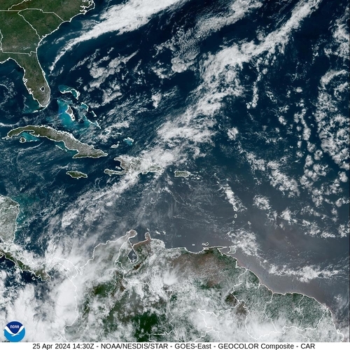
Satellietbeeld