Weerwaarschuwingen Verenigd Koninkrijk
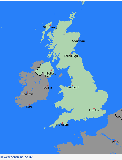
Warning UK Day 0

Warning UK Day 1

Warning UK Day 2

Warning UK Day 3

Warning UK Day 4

Warning UK Day 0
00:00-06:00

Warning UK Day 0
06:00-12:00

Warning UK Day 0
12:00-18:00

Warning UK Day 0
18:00-24:00


Be aware
 
Be prepared
 
Take action
Coloured regions on the map show where severe weather warnings have been issued.
Warning wind
Wind
Warning rain
Rain
Warning snow
Snow
Warning ice
Ice
Warning fog
Fog
Weerwaarschuwingen, 24.01.2025, Verenigd Koninkrijk

Severe Weather Warnings: Wind

Datum

issued by the Metoffice at
   14:00, 24.01.2025

valid from
   00:00, 24.01.2025
until
   23:59, 24.01.2025


Regio: Orkney-eilanden & Shetlandeilanden

Warning

Storm Éowyn will move across the northwest of the UK on Friday, clearing to the northeast on Friday night. This will bring a spell of strong west or southwesterly winds with peak gusts of 50-60 mph inland, 60-70 mph around some coasts and hills, and over 80 mph in exposed parts of northern UK. Note that in addition to this warning, red and amber warnings remain in force for some areas. What Should I Do? Prepare to protect your property and people from injury. Check for loose items outside your home and plan how you could secure them. Items include; bins, garden furniture, trampolines, tents, sheds, and fences. Give yourself the best chance of avoiding delays by checking road conditions if driving, or bus and train timetables, amending your travel plans if necessary. People cope better with power cuts when they have prepared for them in advance. It’s easy to do; consider gathering torches and batteries, a mobile phone power pack and other essential items. If you are on the coast, stay safe during stormy weather by being aware of large waves. Even from the shore large breaking waves can sweep you off your feet and out to sea. Take care if walking near cliffs; know your route and keep dogs on a lead. In an emergency, call 999 and ask for the Coastguard. Be prepared for weather warnings to change quickly. When a weather warning is issued, the Met Office recommends staying up to date with the weather forecast in your area.

Chief Forecaster

Storm Éowyn is expected to bring very strong winds and some disruption on Friday

The public is advised to take extra care, further information and advice can be found here: http://www.metoffice.gov.uk/weather/uk/links.html

Local Authorities: Orkney Islands, Shetland Islands

Severe Weather Warnings: Wind

Datum

issued by the Metoffice at
   14:00, 24.01.2025

valid from
   13:00, 24.01.2025
until
   06:00, 25.01.2025


Regio: Orkney-eilanden & Shetlandeilanden

Warning

Storm Éowyn will move across the northwest of the UK on Friday, clearing to the northeast on Friday night and through Saturday morning. This will bring a spell of very strong west to southwesterly winds, with peak gusts of 60-70 mph fairly widely inland, 70-80 mph in some areas, and 80-90 mph along more exposed coasts and hills (perhaps even higher in a few locations). Winds will gradually ease from the south during Friday night and Saturday morning. What Should I Do? Prepare to protect your property and people from injury. Check for loose items outside your home and plan how you could secure them. Items include; bins, garden furniture, trampolines, tents, sheds, and fences. Give yourself the best chance of avoiding delays by checking road conditions if driving, or bus and train timetables, amending your travel plans if necessary. People cope better with power cuts when they have prepared for them in advance. It’s easy to do; consider gathering torches and batteries, a mobile phone power pack and other essential items. If you are on the coast, stay safe during stormy weather by being aware of large waves. Even from the shore large breaking waves can sweep you off your feet and out to sea. Take care if walking near cliffs; know your route and keep dogs on a lead. In an emergency, call 999 and ask for the Coastguard. Be prepared for weather warnings to change quickly. When a weather warning is issued, the Met Office recommends staying up to date with the weather forecast in your area.

Chief Forecaster

Storm Éowyn is expected to bring very strong winds and widespread disruption later on Friday and into early Saturday

The public is advised to take extra care, further information and advice can be found here: http://www.metoffice.gov.uk/weather/uk/links.html

Local Authorities: Orkney Islands, Shetland Islands

Severe Weather Warnings: Wind

Datum

issued by the Metoffice at
   14:00, 24.01.2025

valid from
   00:00, 24.01.2025
until
   23:59, 24.01.2025


Regio: Highland & Eilean Siar

Warning

Storm Éowyn will move across the northwest of the UK on Friday, clearing to the northeast on Friday night. This will bring a spell of strong west or southwesterly winds with peak gusts of 50-60 mph inland, 60-70 mph around some coasts and hills, and over 80 mph in exposed parts of northern UK. Note that in addition to this warning, red and amber warnings remain in force for some areas. What Should I Do? Prepare to protect your property and people from injury. Check for loose items outside your home and plan how you could secure them. Items include; bins, garden furniture, trampolines, tents, sheds, and fences. Give yourself the best chance of avoiding delays by checking road conditions if driving, or bus and train timetables, amending your travel plans if necessary. People cope better with power cuts when they have prepared for them in advance. It’s easy to do; consider gathering torches and batteries, a mobile phone power pack and other essential items. If you are on the coast, stay safe during stormy weather by being aware of large waves. Even from the shore large breaking waves can sweep you off your feet and out to sea. Take care if walking near cliffs; know your route and keep dogs on a lead. In an emergency, call 999 and ask for the Coastguard. Be prepared for weather warnings to change quickly. When a weather warning is issued, the Met Office recommends staying up to date with the weather forecast in your area.

Chief Forecaster

Storm Éowyn is expected to bring very strong winds and some disruption on Friday

The public is advised to take extra care, further information and advice can be found here: http://www.metoffice.gov.uk/weather/uk/links.html

Local Authorities: Eilean Siar, Highland

Severe Weather Warnings: Wind

Datum

issued by the Metoffice at
   14:00, 24.01.2025

valid from
   13:00, 24.01.2025
until
   06:00, 25.01.2025


Regio: Highland & Eilean Siar

Warning

Storm Éowyn will move across the northwest of the UK on Friday, clearing to the northeast on Friday night and through Saturday morning. This will bring a spell of very strong west to southwesterly winds, with peak gusts of 60-70 mph fairly widely inland, 70-80 mph in some areas, and 80-90 mph along more exposed coasts and hills (perhaps even higher in a few locations). Winds will gradually ease from the south during Friday night and Saturday morning. What Should I Do? Prepare to protect your property and people from injury. Check for loose items outside your home and plan how you could secure them. Items include; bins, garden furniture, trampolines, tents, sheds, and fences. Give yourself the best chance of avoiding delays by checking road conditions if driving, or bus and train timetables, amending your travel plans if necessary. People cope better with power cuts when they have prepared for them in advance. It’s easy to do; consider gathering torches and batteries, a mobile phone power pack and other essential items. If you are on the coast, stay safe during stormy weather by being aware of large waves. Even from the shore large breaking waves can sweep you off your feet and out to sea. Take care if walking near cliffs; know your route and keep dogs on a lead. In an emergency, call 999 and ask for the Coastguard. Be prepared for weather warnings to change quickly. When a weather warning is issued, the Met Office recommends staying up to date with the weather forecast in your area.

Chief Forecaster

Storm Éowyn is expected to bring very strong winds and widespread disruption later on Friday and into early Saturday

The public is advised to take extra care, further information and advice can be found here: http://www.metoffice.gov.uk/weather/uk/links.html

Local Authorities: Eilean Siar, Highland

Severe Weather Warnings: Sneeuw/IJs

Datum

issued by the Metoffice at
   14:00, 24.01.2025

valid from
   00:00, 25.01.2025
until
   11:00, 25.01.2025


Regio: Highland & Eilean Siar

Warning

Snow showers will continue to affect Scotland overnight into Saturday morning. Snow accumulations will mainly be confined to high ground, above roughly 200 metres, where 5-10 cm could develop in places. Ice will be a more significant hazard with icy stretches forming on untreated surfaces as temperatures fall below freezing. What Should I Do? Snowy, wintry weather can cause delays and make driving conditions dangerous. Keep yourself and others safe by planning your route, giving yourself extra time for your journey. Check for road closures or delays to public transport and amend plans if necessary. If driving, make sure you have some essentials in your car in the event of any delays (e.g., warm clothing, food, water, a blanket, a torch, ice scraper/de icer, a warning triangle, high visibility vest and an in-car phone charger). Keep yourself and your family safe when it is icy. Plan to leave the house at least five minutes earlier than normal. Not needing to rush, reduces your risk of accidents, slips, and falls. If you need to make a journey on foot, try to use pavements along main roads which are likely to be less slippery. Similarly, if cycling, try and stick to main roads which are more likely to have been treated. Be prepared for weather warnings to change: when a weather warning is issued, the Met Office recommends staying up to date with the weather forecast in your area.

Chief Forecaster

Icy stretches and some snow showers will result in some hazardous driving conditions.

The public is advised to take extra care, further information and advice can be found here: http://www.metoffice.gov.uk/weather/uk/links.html

Local Authorities: Highland

Severe Weather Warnings: Sneeuw

Datum

issued by the Metoffice at
   14:00, 24.01.2025

valid from
   06:00, 24.01.2025
until
   23:59, 24.01.2025


Regio: Highland & Eilean Siar

Warning

Outbreaks of rain spreading northeastwards on Friday morning will fall as snow initially, especially on hills, before reverting to rain and eventually easing. As much as 15-25 cm is possible above 300 m. Given the strong winds that will accompany the snow, temporary blizzard conditions are possible over higher ground, with some drifting also possible for a time. A lower levels, snow will be more transient in nature and accumulations smaller, patchier and shorter-lived as snow turns to rain during the morning. What Should I Do? Snowy, wintry weather can cause delays and make driving conditions dangerous. Keep yourself and others safe by planning your route, giving yourself extra time for your journey. Check for road closures or delays to public transport and amend plans if necessary. If driving, make sure you have some essentials in your car in the event of any delays (e.g., warm clothing, food, water, a blanket, a torch, ice scraper/de-icer, a warning triangle, high visibility vest and an in-car phone charger). Be prepared for weather warnings to change quickly: when a weather warning is issued, the Met Office recommends staying up to date with the weather forecast in your area.

Chief Forecaster

Snow for a time on Friday morning may cause some disruption, before easing and/or turning to rain

The public is advised to take extra care, further information and advice can be found here: http://www.metoffice.gov.uk/weather/uk/links.html

Local Authorities: Highland

Severe Weather Warnings: Wind

Datum

issued by the Metoffice at
   14:00, 24.01.2025

valid from
   13:00, 24.01.2025
until
   06:00, 25.01.2025


Regio: Grampian

Warning

Storm Éowyn will move across the northwest of the UK on Friday, clearing to the northeast on Friday night and through Saturday morning. This will bring a spell of very strong west to southwesterly winds, with peak gusts of 60-70 mph fairly widely inland, 70-80 mph in some areas, and 80-90 mph along more exposed coasts and hills (perhaps even higher in a few locations). Winds will gradually ease from the south during Friday night and Saturday morning. What Should I Do? Prepare to protect your property and people from injury. Check for loose items outside your home and plan how you could secure them. Items include; bins, garden furniture, trampolines, tents, sheds, and fences. Give yourself the best chance of avoiding delays by checking road conditions if driving, or bus and train timetables, amending your travel plans if necessary. People cope better with power cuts when they have prepared for them in advance. It’s easy to do; consider gathering torches and batteries, a mobile phone power pack and other essential items. If you are on the coast, stay safe during stormy weather by being aware of large waves. Even from the shore large breaking waves can sweep you off your feet and out to sea. Take care if walking near cliffs; know your route and keep dogs on a lead. In an emergency, call 999 and ask for the Coastguard. Be prepared for weather warnings to change quickly. When a weather warning is issued, the Met Office recommends staying up to date with the weather forecast in your area.

Chief Forecaster

Storm Éowyn is expected to bring very strong winds and widespread disruption later on Friday and into early Saturday

The public is advised to take extra care, further information and advice can be found here: http://www.metoffice.gov.uk/weather/uk/links.html

Local Authorities: Aberdeen, Aberdeenshire, Moray

Severe Weather Warnings: Wind

Datum

issued by the Metoffice at
   14:00, 24.01.2025

valid from
   00:00, 24.01.2025
until
   23:59, 24.01.2025


Regio: Grampian

Warning

Storm Éowyn will move across the northwest of the UK on Friday, clearing to the northeast on Friday night. This will bring a spell of strong west or southwesterly winds with peak gusts of 50-60 mph inland, 60-70 mph around some coasts and hills, and over 80 mph in exposed parts of northern UK. Note that in addition to this warning, red and amber warnings remain in force for some areas. What Should I Do? Prepare to protect your property and people from injury. Check for loose items outside your home and plan how you could secure them. Items include; bins, garden furniture, trampolines, tents, sheds, and fences. Give yourself the best chance of avoiding delays by checking road conditions if driving, or bus and train timetables, amending your travel plans if necessary. People cope better with power cuts when they have prepared for them in advance. It’s easy to do; consider gathering torches and batteries, a mobile phone power pack and other essential items. If you are on the coast, stay safe during stormy weather by being aware of large waves. Even from the shore large breaking waves can sweep you off your feet and out to sea. Take care if walking near cliffs; know your route and keep dogs on a lead. In an emergency, call 999 and ask for the Coastguard. Be prepared for weather warnings to change quickly. When a weather warning is issued, the Met Office recommends staying up to date with the weather forecast in your area.

Chief Forecaster

Storm Éowyn is expected to bring very strong winds and some disruption on Friday

The public is advised to take extra care, further information and advice can be found here: http://www.metoffice.gov.uk/weather/uk/links.html

Local Authorities: Aberdeen, Aberdeenshire, Moray

Severe Weather Warnings: Sneeuw

Datum

issued by the Metoffice at
   14:00, 24.01.2025

valid from
   06:00, 24.01.2025
until
   23:59, 24.01.2025


Regio: Grampian

Warning

Outbreaks of rain spreading northeastwards on Friday morning will fall as snow initially, especially on hills, before reverting to rain and eventually easing. As much as 15-25 cm is possible above 300 m. Given the strong winds that will accompany the snow, temporary blizzard conditions are possible over higher ground, with some drifting also possible for a time. A lower levels, snow will be more transient in nature and accumulations smaller, patchier and shorter-lived as snow turns to rain during the morning. What Should I Do? Snowy, wintry weather can cause delays and make driving conditions dangerous. Keep yourself and others safe by planning your route, giving yourself extra time for your journey. Check for road closures or delays to public transport and amend plans if necessary. If driving, make sure you have some essentials in your car in the event of any delays (e.g., warm clothing, food, water, a blanket, a torch, ice scraper/de-icer, a warning triangle, high visibility vest and an in-car phone charger). Be prepared for weather warnings to change quickly: when a weather warning is issued, the Met Office recommends staying up to date with the weather forecast in your area.

Chief Forecaster

Snow for a time on Friday morning may cause some disruption, before easing and/or turning to rain

The public is advised to take extra care, further information and advice can be found here: http://www.metoffice.gov.uk/weather/uk/links.html

Local Authorities: Aberdeenshire, Moray

Severe Weather Warnings: Sneeuw/IJs

Datum

issued by the Metoffice at
   14:00, 24.01.2025

valid from
   00:00, 25.01.2025
until
   11:00, 25.01.2025


Regio: Grampian

Warning

Snow showers will continue to affect Scotland overnight into Saturday morning. Snow accumulations will mainly be confined to high ground, above roughly 200 metres, where 5-10 cm could develop in places. Ice will be a more significant hazard with icy stretches forming on untreated surfaces as temperatures fall below freezing. What Should I Do? Snowy, wintry weather can cause delays and make driving conditions dangerous. Keep yourself and others safe by planning your route, giving yourself extra time for your journey. Check for road closures or delays to public transport and amend plans if necessary. If driving, make sure you have some essentials in your car in the event of any delays (e.g., warm clothing, food, water, a blanket, a torch, ice scraper/de icer, a warning triangle, high visibility vest and an in-car phone charger). Keep yourself and your family safe when it is icy. Plan to leave the house at least five minutes earlier than normal. Not needing to rush, reduces your risk of accidents, slips, and falls. If you need to make a journey on foot, try to use pavements along main roads which are likely to be less slippery. Similarly, if cycling, try and stick to main roads which are more likely to have been treated. Be prepared for weather warnings to change: when a weather warning is issued, the Met Office recommends staying up to date with the weather forecast in your area.

Chief Forecaster

Icy stretches and some snow showers will result in some hazardous driving conditions.

The public is advised to take extra care, further information and advice can be found here: http://www.metoffice.gov.uk/weather/uk/links.html

Local Authorities: Aberdeen, Aberdeenshire, Moray

Severe Weather Warnings: Wind

Datum

issued by the Metoffice at
   14:00, 24.01.2025

valid from
   13:00, 24.01.2025
until
   06:00, 25.01.2025


Regio: Strathclyde

Warning

Storm Éowyn will move across the northwest of the UK on Friday, clearing to the northeast on Friday night and through Saturday morning. This will bring a spell of very strong west to southwesterly winds, with peak gusts of 60-70 mph fairly widely inland, 70-80 mph in some areas, and 80-90 mph along more exposed coasts and hills (perhaps even higher in a few locations). Winds will gradually ease from the south during Friday night and Saturday morning. What Should I Do? Prepare to protect your property and people from injury. Check for loose items outside your home and plan how you could secure them. Items include; bins, garden furniture, trampolines, tents, sheds, and fences. Give yourself the best chance of avoiding delays by checking road conditions if driving, or bus and train timetables, amending your travel plans if necessary. People cope better with power cuts when they have prepared for them in advance. It’s easy to do; consider gathering torches and batteries, a mobile phone power pack and other essential items. If you are on the coast, stay safe during stormy weather by being aware of large waves. Even from the shore large breaking waves can sweep you off your feet and out to sea. Take care if walking near cliffs; know your route and keep dogs on a lead. In an emergency, call 999 and ask for the Coastguard. Be prepared for weather warnings to change quickly. When a weather warning is issued, the Met Office recommends staying up to date with the weather forecast in your area.

Chief Forecaster

Storm Éowyn is expected to bring very strong winds and widespread disruption later on Friday and into early Saturday

The public is advised to take extra care, further information and advice can be found here: http://www.metoffice.gov.uk/weather/uk/links.html

Local Authorities: Argyll and Bute

Severe Weather Warnings: Wind

Datum

issued by the Metoffice at
   14:00, 24.01.2025

valid from
   00:00, 24.01.2025
until
   23:59, 24.01.2025


Regio: Strathclyde

Warning

Storm Éowyn will move across the northwest of the UK on Friday, clearing to the northeast on Friday night. This will bring a spell of strong west or southwesterly winds with peak gusts of 50-60 mph inland, 60-70 mph around some coasts and hills, and over 80 mph in exposed parts of northern UK. Note that in addition to this warning, red and amber warnings remain in force for some areas. What Should I Do? Prepare to protect your property and people from injury. Check for loose items outside your home and plan how you could secure them. Items include; bins, garden furniture, trampolines, tents, sheds, and fences. Give yourself the best chance of avoiding delays by checking road conditions if driving, or bus and train timetables, amending your travel plans if necessary. People cope better with power cuts when they have prepared for them in advance. It’s easy to do; consider gathering torches and batteries, a mobile phone power pack and other essential items. If you are on the coast, stay safe during stormy weather by being aware of large waves. Even from the shore large breaking waves can sweep you off your feet and out to sea. Take care if walking near cliffs; know your route and keep dogs on a lead. In an emergency, call 999 and ask for the Coastguard. Be prepared for weather warnings to change quickly. When a weather warning is issued, the Met Office recommends staying up to date with the weather forecast in your area.

Chief Forecaster

Storm Éowyn is expected to bring very strong winds and some disruption on Friday

The public is advised to take extra care, further information and advice can be found here: http://www.metoffice.gov.uk/weather/uk/links.html

Local Authorities: Argyll and Bute, East Ayrshire, East Dunbartonshire, East Renfrewshire, Glasgow, Inverclyde, North Ayrshire, North Lanarkshire, Renfrewshire, South Ayrshire, South Lanarkshire, West Dunbartonshire

Severe Weather Warnings: Wind

Datum

issued by the Metoffice at
   14:00, 24.01.2025

valid from
   10:00, 24.01.2025
until
   17:00, 24.01.2025


Regio: Strathclyde

Warning

Southwesterly then westerly winds will rapidly increase from west to east Friday mid-morning onwards into the afternoon, with peak gusts of 80-90 mph fairly widely and perhaps up to 100 mph along exposed western coasts. This brings the risk of significant disruption to transport and power supplies as well as dangerous conditions outdoors. Winds will gradually ease through Friday evening. What Should I Do? Keep yourself and others safe; avoid travelling by road during potentially dangerous conditions. It is not safe to drive in these conditions. Don't risk injury to others or damage to your property. If you can do so safely, check for loose items outside your home and secure them. Items include; bins, garden furniture, trampolines, tents, sheds, and fences. Being outside in high winds makes you vulnerable to injury. Stay indoors if you can. People cope better with power cuts when they have prepared for them in advance. It’s easy to do; consider gathering torches and batteries, a mobile phone power pack and other essential items. If you live or work on the coast, beware of large waves, even from the shore large breaking waves can sweep you off your feet and out to sea. In an emergency, call 999 and ask for the Coastguard. Stay up to date with the weather forecast for your area and follow advice from emergency services and local authorities.

Chief Forecaster

Very strong winds associated with Storm Éowyn causing very dangerous conditions and significant disruption on Friday

The public is advised to take extra care, further information and advice can be found here: http://www.metoffice.gov.uk/weather/uk/links.html

Local Authorities: Argyll and Bute, East Ayrshire, East Dunbartonshire, East Renfrewshire, Glasgow, Inverclyde, North Ayrshire, North Lanarkshire, Renfrewshire, South Ayrshire, South Lanarkshire, West Dunbartonshire

Severe Weather Warnings: Sneeuw/IJs

Datum

issued by the Metoffice at
   14:00, 24.01.2025

valid from
   00:00, 25.01.2025
until
   11:00, 25.01.2025


Regio: Strathclyde

Warning

Snow showers will continue to affect Scotland overnight into Saturday morning. Snow accumulations will mainly be confined to high ground, above roughly 200 metres, where 5-10 cm could develop in places. Ice will be a more significant hazard with icy stretches forming on untreated surfaces as temperatures fall below freezing. What Should I Do? Snowy, wintry weather can cause delays and make driving conditions dangerous. Keep yourself and others safe by planning your route, giving yourself extra time for your journey. Check for road closures or delays to public transport and amend plans if necessary. If driving, make sure you have some essentials in your car in the event of any delays (e.g., warm clothing, food, water, a blanket, a torch, ice scraper/de icer, a warning triangle, high visibility vest and an in-car phone charger). Keep yourself and your family safe when it is icy. Plan to leave the house at least five minutes earlier than normal. Not needing to rush, reduces your risk of accidents, slips, and falls. If you need to make a journey on foot, try to use pavements along main roads which are likely to be less slippery. Similarly, if cycling, try and stick to main roads which are more likely to have been treated. Be prepared for weather warnings to change: when a weather warning is issued, the Met Office recommends staying up to date with the weather forecast in your area.

Chief Forecaster

Icy stretches and some snow showers will result in some hazardous driving conditions.

The public is advised to take extra care, further information and advice can be found here: http://www.metoffice.gov.uk/weather/uk/links.html

Local Authorities: Argyll and Bute, East Ayrshire, East Dunbartonshire, East Renfrewshire, Glasgow, Inverclyde, North Ayrshire, North Lanarkshire, Renfrewshire, South Ayrshire, South Lanarkshire, West Dunbartonshire

Severe Weather Warnings: Sneeuw

Datum

issued by the Metoffice at
   14:00, 24.01.2025

valid from
   06:00, 24.01.2025
until
   23:59, 24.01.2025


Regio: Strathclyde

Warning

Outbreaks of rain spreading northeastwards on Friday morning will fall as snow initially, especially on hills, before reverting to rain and eventually easing. As much as 15-25 cm is possible above 300 m. Given the strong winds that will accompany the snow, temporary blizzard conditions are possible over higher ground, with some drifting also possible for a time. A lower levels, snow will be more transient in nature and accumulations smaller, patchier and shorter-lived as snow turns to rain during the morning. What Should I Do? Snowy, wintry weather can cause delays and make driving conditions dangerous. Keep yourself and others safe by planning your route, giving yourself extra time for your journey. Check for road closures or delays to public transport and amend plans if necessary. If driving, make sure you have some essentials in your car in the event of any delays (e.g., warm clothing, food, water, a blanket, a torch, ice scraper/de-icer, a warning triangle, high visibility vest and an in-car phone charger). Be prepared for weather warnings to change quickly: when a weather warning is issued, the Met Office recommends staying up to date with the weather forecast in your area.

Chief Forecaster

Snow for a time on Friday morning may cause some disruption, before easing and/or turning to rain

The public is advised to take extra care, further information and advice can be found here: http://www.metoffice.gov.uk/weather/uk/links.html

Local Authorities: Argyll and Bute

Severe Weather Warnings: Sneeuw

Datum

issued by the Metoffice at
   14:00, 24.01.2025

valid from
   06:00, 24.01.2025
until
   23:59, 24.01.2025


Regio: Central, Tayside & Fife

Warning

Outbreaks of rain spreading northeastwards on Friday morning will fall as snow initially, especially on hills, before reverting to rain and eventually easing. As much as 15-25 cm is possible above 300 m. Given the strong winds that will accompany the snow, temporary blizzard conditions are possible over higher ground, with some drifting also possible for a time. A lower levels, snow will be more transient in nature and accumulations smaller, patchier and shorter-lived as snow turns to rain during the morning. What Should I Do? Snowy, wintry weather can cause delays and make driving conditions dangerous. Keep yourself and others safe by planning your route, giving yourself extra time for your journey. Check for road closures or delays to public transport and amend plans if necessary. If driving, make sure you have some essentials in your car in the event of any delays (e.g., warm clothing, food, water, a blanket, a torch, ice scraper/de-icer, a warning triangle, high visibility vest and an in-car phone charger). Be prepared for weather warnings to change quickly: when a weather warning is issued, the Met Office recommends staying up to date with the weather forecast in your area.

Chief Forecaster

Snow for a time on Friday morning may cause some disruption, before easing and/or turning to rain

The public is advised to take extra care, further information and advice can be found here: http://www.metoffice.gov.uk/weather/uk/links.html

Local Authorities: Angus, Perth and Kinross, Stirling

Severe Weather Warnings: Wind

Datum

issued by the Metoffice at
   14:00, 24.01.2025

valid from
   10:00, 24.01.2025
until
   17:00, 24.01.2025


Regio: Central, Tayside & Fife

Warning

Southwesterly then westerly winds will rapidly increase from west to east Friday mid-morning onwards into the afternoon, with peak gusts of 80-90 mph fairly widely and perhaps up to 100 mph along exposed western coasts. This brings the risk of significant disruption to transport and power supplies as well as dangerous conditions outdoors. Winds will gradually ease through Friday evening. What Should I Do? Keep yourself and others safe; avoid travelling by road during potentially dangerous conditions. It is not safe to drive in these conditions. Don't risk injury to others or damage to your property. If you can do so safely, check for loose items outside your home and secure them. Items include; bins, garden furniture, trampolines, tents, sheds, and fences. Being outside in high winds makes you vulnerable to injury. Stay indoors if you can. People cope better with power cuts when they have prepared for them in advance. It’s easy to do; consider gathering torches and batteries, a mobile phone power pack and other essential items. If you live or work on the coast, beware of large waves, even from the shore large breaking waves can sweep you off your feet and out to sea. In an emergency, call 999 and ask for the Coastguard. Stay up to date with the weather forecast for your area and follow advice from emergency services and local authorities.

Chief Forecaster

Very strong winds associated with Storm Éowyn causing very dangerous conditions and significant disruption on Friday

The public is advised to take extra care, further information and advice can be found here: http://www.metoffice.gov.uk/weather/uk/links.html

Local Authorities: Clackmannanshire, Falkirk, Fife, Stirling

Severe Weather Warnings: Sneeuw/IJs

Datum

issued by the Metoffice at
   14:00, 24.01.2025

valid from
   00:00, 25.01.2025
until
   11:00, 25.01.2025


Regio: Central, Tayside & Fife

Warning

Snow showers will continue to affect Scotland overnight into Saturday morning. Snow accumulations will mainly be confined to high ground, above roughly 200 metres, where 5-10 cm could develop in places. Ice will be a more significant hazard with icy stretches forming on untreated surfaces as temperatures fall below freezing. What Should I Do? Snowy, wintry weather can cause delays and make driving conditions dangerous. Keep yourself and others safe by planning your route, giving yourself extra time for your journey. Check for road closures or delays to public transport and amend plans if necessary. If driving, make sure you have some essentials in your car in the event of any delays (e.g., warm clothing, food, water, a blanket, a torch, ice scraper/de icer, a warning triangle, high visibility vest and an in-car phone charger). Keep yourself and your family safe when it is icy. Plan to leave the house at least five minutes earlier than normal. Not needing to rush, reduces your risk of accidents, slips, and falls. If you need to make a journey on foot, try to use pavements along main roads which are likely to be less slippery. Similarly, if cycling, try and stick to main roads which are more likely to have been treated. Be prepared for weather warnings to change: when a weather warning is issued, the Met Office recommends staying up to date with the weather forecast in your area.

Chief Forecaster

Icy stretches and some snow showers will result in some hazardous driving conditions.

The public is advised to take extra care, further information and advice can be found here: http://www.metoffice.gov.uk/weather/uk/links.html

Local Authorities: Angus, Clackmannanshire, Dundee, Falkirk, Fife, Perth and Kinross, Stirling

Severe Weather Warnings: Wind

Datum

issued by the Metoffice at
   14:00, 24.01.2025

valid from
   13:00, 24.01.2025
until
   06:00, 25.01.2025


Regio: Central, Tayside & Fife

Warning

Storm Éowyn will move across the northwest of the UK on Friday, clearing to the northeast on Friday night and through Saturday morning. This will bring a spell of very strong west to southwesterly winds, with peak gusts of 60-70 mph fairly widely inland, 70-80 mph in some areas, and 80-90 mph along more exposed coasts and hills (perhaps even higher in a few locations). Winds will gradually ease from the south during Friday night and Saturday morning. What Should I Do? Prepare to protect your property and people from injury. Check for loose items outside your home and plan how you could secure them. Items include; bins, garden furniture, trampolines, tents, sheds, and fences. Give yourself the best chance of avoiding delays by checking road conditions if driving, or bus and train timetables, amending your travel plans if necessary. People cope better with power cuts when they have prepared for them in advance. It’s easy to do; consider gathering torches and batteries, a mobile phone power pack and other essential items. If you are on the coast, stay safe during stormy weather by being aware of large waves. Even from the shore large breaking waves can sweep you off your feet and out to sea. Take care if walking near cliffs; know your route and keep dogs on a lead. In an emergency, call 999 and ask for the Coastguard. Be prepared for weather warnings to change quickly. When a weather warning is issued, the Met Office recommends staying up to date with the weather forecast in your area.

Chief Forecaster

Storm Éowyn is expected to bring very strong winds and widespread disruption later on Friday and into early Saturday

The public is advised to take extra care, further information and advice can be found here: http://www.metoffice.gov.uk/weather/uk/links.html

Local Authorities: Angus, Perth and Kinross, Stirling

Severe Weather Warnings: Wind

Datum

issued by the Metoffice at
   14:00, 24.01.2025

valid from
   00:00, 24.01.2025
until
   23:59, 24.01.2025


Regio: Central, Tayside & Fife

Warning

Storm Éowyn will move across the northwest of the UK on Friday, clearing to the northeast on Friday night. This will bring a spell of strong west or southwesterly winds with peak gusts of 50-60 mph inland, 60-70 mph around some coasts and hills, and over 80 mph in exposed parts of northern UK. Note that in addition to this warning, red and amber warnings remain in force for some areas. What Should I Do? Prepare to protect your property and people from injury. Check for loose items outside your home and plan how you could secure them. Items include; bins, garden furniture, trampolines, tents, sheds, and fences. Give yourself the best chance of avoiding delays by checking road conditions if driving, or bus and train timetables, amending your travel plans if necessary. People cope better with power cuts when they have prepared for them in advance. It’s easy to do; consider gathering torches and batteries, a mobile phone power pack and other essential items. If you are on the coast, stay safe during stormy weather by being aware of large waves. Even from the shore large breaking waves can sweep you off your feet and out to sea. Take care if walking near cliffs; know your route and keep dogs on a lead. In an emergency, call 999 and ask for the Coastguard. Be prepared for weather warnings to change quickly. When a weather warning is issued, the Met Office recommends staying up to date with the weather forecast in your area.

Chief Forecaster

Storm Éowyn is expected to bring very strong winds and some disruption on Friday

The public is advised to take extra care, further information and advice can be found here: http://www.metoffice.gov.uk/weather/uk/links.html

Local Authorities: Angus, Clackmannanshire, Dundee, Falkirk, Fife, Perth and Kinross, Stirling

Severe Weather Warnings: Wind

Datum

issued by the Metoffice at
   14:00, 24.01.2025

valid from
   10:00, 24.01.2025
until
   17:00, 24.01.2025


Regio: SW Scotland, Lothian Borders

Warning

Southwesterly then westerly winds will rapidly increase from west to east Friday mid-morning onwards into the afternoon, with peak gusts of 80-90 mph fairly widely and perhaps up to 100 mph along exposed western coasts. This brings the risk of significant disruption to transport and power supplies as well as dangerous conditions outdoors. Winds will gradually ease through Friday evening. What Should I Do? Keep yourself and others safe; avoid travelling by road during potentially dangerous conditions. It is not safe to drive in these conditions. Don't risk injury to others or damage to your property. If you can do so safely, check for loose items outside your home and secure them. Items include; bins, garden furniture, trampolines, tents, sheds, and fences. Being outside in high winds makes you vulnerable to injury. Stay indoors if you can. People cope better with power cuts when they have prepared for them in advance. It’s easy to do; consider gathering torches and batteries, a mobile phone power pack and other essential items. If you live or work on the coast, beware of large waves, even from the shore large breaking waves can sweep you off your feet and out to sea. In an emergency, call 999 and ask for the Coastguard. Stay up to date with the weather forecast for your area and follow advice from emergency services and local authorities.

Chief Forecaster

Very strong winds associated with Storm Éowyn causing very dangerous conditions and significant disruption on Friday

The public is advised to take extra care, further information and advice can be found here: http://www.metoffice.gov.uk/weather/uk/links.html

Local Authorities: Dumfries and Galloway, East Lothian, Edinburgh, Midlothian Council, Scottish Borders, West Lothian

Severe Weather Warnings: Sneeuw/IJs

Datum

issued by the Metoffice at
   14:00, 24.01.2025

valid from
   00:00, 25.01.2025
until
   11:00, 25.01.2025


Regio: SW Scotland, Lothian Borders

Warning

Snow showers will continue to affect Scotland overnight into Saturday morning. Snow accumulations will mainly be confined to high ground, above roughly 200 metres, where 5-10 cm could develop in places. Ice will be a more significant hazard with icy stretches forming on untreated surfaces as temperatures fall below freezing. What Should I Do? Snowy, wintry weather can cause delays and make driving conditions dangerous. Keep yourself and others safe by planning your route, giving yourself extra time for your journey. Check for road closures or delays to public transport and amend plans if necessary. If driving, make sure you have some essentials in your car in the event of any delays (e.g., warm clothing, food, water, a blanket, a torch, ice scraper/de icer, a warning triangle, high visibility vest and an in-car phone charger). Keep yourself and your family safe when it is icy. Plan to leave the house at least five minutes earlier than normal. Not needing to rush, reduces your risk of accidents, slips, and falls. If you need to make a journey on foot, try to use pavements along main roads which are likely to be less slippery. Similarly, if cycling, try and stick to main roads which are more likely to have been treated. Be prepared for weather warnings to change: when a weather warning is issued, the Met Office recommends staying up to date with the weather forecast in your area.

Chief Forecaster

Icy stretches and some snow showers will result in some hazardous driving conditions.

The public is advised to take extra care, further information and advice can be found here: http://www.metoffice.gov.uk/weather/uk/links.html

Local Authorities: Dumfries and Galloway, East Lothian, Edinburgh, Midlothian Council, Scottish Borders, West Lothian

Severe Weather Warnings: Wind

Datum

issued by the Metoffice at
   14:00, 24.01.2025

valid from
   00:00, 24.01.2025
until
   23:59, 24.01.2025


Regio: SW Scotland, Lothian Borders

Warning

Storm Éowyn will move across the northwest of the UK on Friday, clearing to the northeast on Friday night. This will bring a spell of strong west or southwesterly winds with peak gusts of 50-60 mph inland, 60-70 mph around some coasts and hills, and over 80 mph in exposed parts of northern UK. Note that in addition to this warning, red and amber warnings remain in force for some areas. What Should I Do? Prepare to protect your property and people from injury. Check for loose items outside your home and plan how you could secure them. Items include; bins, garden furniture, trampolines, tents, sheds, and fences. Give yourself the best chance of avoiding delays by checking road conditions if driving, or bus and train timetables, amending your travel plans if necessary. People cope better with power cuts when they have prepared for them in advance. It’s easy to do; consider gathering torches and batteries, a mobile phone power pack and other essential items. If you are on the coast, stay safe during stormy weather by being aware of large waves. Even from the shore large breaking waves can sweep you off your feet and out to sea. Take care if walking near cliffs; know your route and keep dogs on a lead. In an emergency, call 999 and ask for the Coastguard. Be prepared for weather warnings to change quickly. When a weather warning is issued, the Met Office recommends staying up to date with the weather forecast in your area.

Chief Forecaster

Storm Éowyn is expected to bring very strong winds and some disruption on Friday

The public is advised to take extra care, further information and advice can be found here: http://www.metoffice.gov.uk/weather/uk/links.html

Local Authorities: Dumfries and Galloway, East Lothian, Edinburgh, Midlothian Council, Scottish Borders, West Lothian

Severe Weather Warnings: Sneeuw/IJs

Datum

issued by the Metoffice at
   14:00, 24.01.2025

valid from
   19:00, 24.01.2025
until
   10:00, 25.01.2025


Regio: Noord-Ierland

Warning

Snow showers are expected to affect Northern Ireland during Friday afternoon and overnight into Saturday morning. Some small snow accumulations could develop in places, mainly on high ground in the west. However, ice is likely to be the main hazard, with icy stretches forming on untreated surfaces as temperatures fall this evening. What Should I Do? Snowy, wintry weather can cause delays and make driving conditions dangerous. Keep yourself and others safe by planning your route, giving yourself extra time for your journey. Check for road closures or delays to public transport and amend plans if necessary. If driving, make sure you have some essentials in your car in the event of any delays (e.g., warm clothing, food, water, a blanket, a torch, ice scraper/de icer, a warning triangle, high visibility vest and an in-car phone charger). Keep yourself and your family safe when it is icy. Plan to leave the house at least five minutes earlier than normal. Not needing to rush, reduces your risk of accidents, slips, and falls. If you need to make a journey on foot, try to use pavements along main roads which are likely to be less slippery. Similarly, if cycling, try and stick to main roads which are more likely to have been treated. Be prepared for weather warnings to change: when a weather warning is issued, the Met Office recommends staying up to date with the weather forecast in your area.

Chief Forecaster

Icy stretches and some snow showers will result in some hazardous driving conditions.

The public is advised to take extra care, further information and advice can be found here: http://www.metoffice.gov.uk/weather/uk/links.html

Local Authorities: County Antrim, County Armagh, County Down, County Fermanagh, County Londonderry, County Tyrone

Severe Weather Warnings: Wind

Datum

issued by the Metoffice at
   14:00, 24.01.2025

valid from
   07:00, 24.01.2025
until
   14:00, 24.01.2025


Regio: Noord-Ierland

Warning

Southwesterly then westerly winds will rapidly increase from west to east during the Friday morning rush hour with peak gusts of 80-90 mph fairly widely and perhaps up to 100 mph along some exposed coasts. This brings the risk of significant disruption to transport and power supplies, as well as dangerous conditions outdoors. Winds will gradually ease from the south through Friday afternoon. What Should I Do? Keep yourself and others safe; avoid travelling by road during potentially dangerous conditions. It is not safe to drive in these conditions. Don't risk injury to others or damage to your property. If you can do so safely, check for loose items outside your home and secure them. Items include; bins, garden furniture, trampolines, tents, sheds, and fences. Being outside in high winds makes you vulnerable to injury. Stay indoors if you can. People cope better with power cuts when they have prepared for them in advance. It’s easy to do; consider gathering torches and batteries, a mobile phone power pack and other essential items. If you live or work on the coast, beware of large waves, even from the shore large breaking waves can sweep you off your feet and out to sea. In an emergency, call 999 and ask for the Coastguard. Stay up to date with the weather forecast for your area and follow advice from emergency services and local authorities.

Chief Forecaster

Very strong winds associated with Storm Éowyn causing very dangerous conditions with widespread disruption and significant impacts expected.

The public is advised to take extra care, further information and advice can be found here: http://www.metoffice.gov.uk/weather/uk/links.html

Local Authorities: County Antrim, County Armagh, County Down, County Fermanagh, County Londonderry, County Tyrone

Severe Weather Warnings: Wind

Datum

issued by the Metoffice at
   14:00, 24.01.2025

valid from
   00:00, 24.01.2025
until
   23:59, 24.01.2025


Regio: Noord-Ierland

Warning

Storm Éowyn will move across the northwest of the UK on Friday, clearing to the northeast on Friday night. This will bring a spell of strong west or southwesterly winds with peak gusts of 50-60 mph inland, 60-70 mph around some coasts and hills, and over 80 mph in exposed parts of northern UK. Note that in addition to this warning, red and amber warnings remain in force for some areas. What Should I Do? Prepare to protect your property and people from injury. Check for loose items outside your home and plan how you could secure them. Items include; bins, garden furniture, trampolines, tents, sheds, and fences. Give yourself the best chance of avoiding delays by checking road conditions if driving, or bus and train timetables, amending your travel plans if necessary. People cope better with power cuts when they have prepared for them in advance. It’s easy to do; consider gathering torches and batteries, a mobile phone power pack and other essential items. If you are on the coast, stay safe during stormy weather by being aware of large waves. Even from the shore large breaking waves can sweep you off your feet and out to sea. Take care if walking near cliffs; know your route and keep dogs on a lead. In an emergency, call 999 and ask for the Coastguard. Be prepared for weather warnings to change quickly. When a weather warning is issued, the Met Office recommends staying up to date with the weather forecast in your area.

Chief Forecaster

Storm Éowyn is expected to bring very strong winds and some disruption on Friday

The public is advised to take extra care, further information and advice can be found here: http://www.metoffice.gov.uk/weather/uk/links.html

Local Authorities: County Antrim, County Armagh, County Down, County Fermanagh, County Londonderry, County Tyrone

Severe Weather Warnings: Wind

Datum

issued by the Metoffice at
   14:00, 24.01.2025

valid from
   00:00, 24.01.2025
until
   23:59, 24.01.2025


Regio: Wales

Warning

Storm Éowyn will move across the northwest of the UK on Friday, clearing to the northeast on Friday night. This will bring a spell of strong west or southwesterly winds with peak gusts of 50-60 mph inland, 60-70 mph around some coasts and hills, and over 80 mph in exposed parts of northern UK. Note that in addition to this warning, red and amber warnings remain in force for some areas. What Should I Do? Prepare to protect your property and people from injury. Check for loose items outside your home and plan how you could secure them. Items include; bins, garden furniture, trampolines, tents, sheds, and fences. Give yourself the best chance of avoiding delays by checking road conditions if driving, or bus and train timetables, amending your travel plans if necessary. People cope better with power cuts when they have prepared for them in advance. It’s easy to do; consider gathering torches and batteries, a mobile phone power pack and other essential items. If you are on the coast, stay safe during stormy weather by being aware of large waves. Even from the shore large breaking waves can sweep you off your feet and out to sea. Take care if walking near cliffs; know your route and keep dogs on a lead. In an emergency, call 999 and ask for the Coastguard. Be prepared for weather warnings to change quickly. When a weather warning is issued, the Met Office recommends staying up to date with the weather forecast in your area.

Chief Forecaster

Storm Éowyn is expected to bring very strong winds and some disruption on Friday

The public is advised to take extra care, further information and advice can be found here: http://www.metoffice.gov.uk/weather/uk/links.html

Local Authorities: Carmarthenshire, Ceredigion, Conwy, Denbighshire, Flintshire, Gwynedd, Isle of Anglesey, Neath Port Talbot, Pembrokeshire, Powys, Swansea, Wrexham

Severe Weather Warnings: Cancelled

Datum

issued by the Metoffice at
   14:00, 24.01.2025

valid from
   00:00, 24.01.2025
until
   09:00, 24.01.2025


Regio: Wales

Cancelled
Local Authorities: Blaenau Gwent, Bridgend, Caerphilly, Cardiff, Carmarthenshire, Ceredigion, Conwy, Gwynedd, Merthyr Tydfil, Monmouthshire, Neath Port Talbot, Newport, Pembrokeshire, Powys, Rhondda Cynon Taf, Swansea, Torfaen, Vale of Glamorgan

Severe Weather Warnings: Wind

Datum

issued by the Metoffice at
   14:00, 24.01.2025

valid from
   00:00, 24.01.2025
until
   23:59, 24.01.2025


Regio: North West England

Warning

Storm Éowyn will move across the northwest of the UK on Friday, clearing to the northeast on Friday night. This will bring a spell of strong west or southwesterly winds with peak gusts of 50-60 mph inland, 60-70 mph around some coasts and hills, and over 80 mph in exposed parts of northern UK. Note that in addition to this warning, red and amber warnings remain in force for some areas. What Should I Do? Prepare to protect your property and people from injury. Check for loose items outside your home and plan how you could secure them. Items include; bins, garden furniture, trampolines, tents, sheds, and fences. Give yourself the best chance of avoiding delays by checking road conditions if driving, or bus and train timetables, amending your travel plans if necessary. People cope better with power cuts when they have prepared for them in advance. It’s easy to do; consider gathering torches and batteries, a mobile phone power pack and other essential items. If you are on the coast, stay safe during stormy weather by being aware of large waves. Even from the shore large breaking waves can sweep you off your feet and out to sea. Take care if walking near cliffs; know your route and keep dogs on a lead. In an emergency, call 999 and ask for the Coastguard. Be prepared for weather warnings to change quickly. When a weather warning is issued, the Met Office recommends staying up to date with the weather forecast in your area.

Chief Forecaster

Storm Éowyn is expected to bring very strong winds and some disruption on Friday

The public is advised to take extra care, further information and advice can be found here: http://www.metoffice.gov.uk/weather/uk/links.html

Local Authorities: Blackburn with Darwen, Blackpool, Cheshire East, Cheshire West and Chester, Cumbria, Greater Manchester, Halton, Lancashire, Merseyside, Warrington

Severe Weather Warnings: Wind

Datum

issued by the Metoffice at
   14:00, 24.01.2025

valid from
   00:00, 24.01.2025
until
   23:59, 24.01.2025


Regio: North East England

Warning

Storm Éowyn will move across the northwest of the UK on Friday, clearing to the northeast on Friday night. This will bring a spell of strong west or southwesterly winds with peak gusts of 50-60 mph inland, 60-70 mph around some coasts and hills, and over 80 mph in exposed parts of northern UK. Note that in addition to this warning, red and amber warnings remain in force for some areas. What Should I Do? Prepare to protect your property and people from injury. Check for loose items outside your home and plan how you could secure them. Items include; bins, garden furniture, trampolines, tents, sheds, and fences. Give yourself the best chance of avoiding delays by checking road conditions if driving, or bus and train timetables, amending your travel plans if necessary. People cope better with power cuts when they have prepared for them in advance. It’s easy to do; consider gathering torches and batteries, a mobile phone power pack and other essential items. If you are on the coast, stay safe during stormy weather by being aware of large waves. Even from the shore large breaking waves can sweep you off your feet and out to sea. Take care if walking near cliffs; know your route and keep dogs on a lead. In an emergency, call 999 and ask for the Coastguard. Be prepared for weather warnings to change quickly. When a weather warning is issued, the Met Office recommends staying up to date with the weather forecast in your area.

Chief Forecaster

Storm Éowyn is expected to bring very strong winds and some disruption on Friday

The public is advised to take extra care, further information and advice can be found here: http://www.metoffice.gov.uk/weather/uk/links.html

Local Authorities: Darlington, Durham, Gateshead, Hartlepool, Middlesbrough, Newcastle upon Tyne, North Tyneside, Northumberland, Redcar and Cleveland, South Tyneside, Stockton-on-Tees, Sunderland

Severe Weather Warnings: Wind

Datum

issued by the Metoffice at
   14:00, 24.01.2025

valid from
   00:00, 24.01.2025
until
   23:59, 24.01.2025


Regio: Yorkshire & Humber

Warning

Storm Éowyn will move across the northwest of the UK on Friday, clearing to the northeast on Friday night. This will bring a spell of strong west or southwesterly winds with peak gusts of 50-60 mph inland, 60-70 mph around some coasts and hills, and over 80 mph in exposed parts of northern UK. Note that in addition to this warning, red and amber warnings remain in force for some areas. What Should I Do? Prepare to protect your property and people from injury. Check for loose items outside your home and plan how you could secure them. Items include; bins, garden furniture, trampolines, tents, sheds, and fences. Give yourself the best chance of avoiding delays by checking road conditions if driving, or bus and train timetables, amending your travel plans if necessary. People cope better with power cuts when they have prepared for them in advance. It’s easy to do; consider gathering torches and batteries, a mobile phone power pack and other essential items. If you are on the coast, stay safe during stormy weather by being aware of large waves. Even from the shore large breaking waves can sweep you off your feet and out to sea. Take care if walking near cliffs; know your route and keep dogs on a lead. In an emergency, call 999 and ask for the Coastguard. Be prepared for weather warnings to change quickly. When a weather warning is issued, the Met Office recommends staying up to date with the weather forecast in your area.

Chief Forecaster

Storm Éowyn is expected to bring very strong winds and some disruption on Friday

The public is advised to take extra care, further information and advice can be found here: http://www.metoffice.gov.uk/weather/uk/links.html

Local Authorities: East Riding of Yorkshire, Kingston upon Hull, North East Lincolnshire, North Lincolnshire, North Yorkshire, South Yorkshire, West Yorkshire, York

Severe Weather Warnings: Wind

Datum

issued by the Metoffice at
   14:00, 24.01.2025

valid from
   00:00, 24.01.2025
until
   23:59, 24.01.2025


Regio: West Midlands

Warning

Storm Éowyn will move across the northwest of the UK on Friday, clearing to the northeast on Friday night. This will bring a spell of strong west or southwesterly winds with peak gusts of 50-60 mph inland, 60-70 mph around some coasts and hills, and over 80 mph in exposed parts of northern UK. Note that in addition to this warning, red and amber warnings remain in force for some areas. What Should I Do? Prepare to protect your property and people from injury. Check for loose items outside your home and plan how you could secure them. Items include; bins, garden furniture, trampolines, tents, sheds, and fences. Give yourself the best chance of avoiding delays by checking road conditions if driving, or bus and train timetables, amending your travel plans if necessary. People cope better with power cuts when they have prepared for them in advance. It’s easy to do; consider gathering torches and batteries, a mobile phone power pack and other essential items. If you are on the coast, stay safe during stormy weather by being aware of large waves. Even from the shore large breaking waves can sweep you off your feet and out to sea. Take care if walking near cliffs; know your route and keep dogs on a lead. In an emergency, call 999 and ask for the Coastguard. Be prepared for weather warnings to change quickly. When a weather warning is issued, the Met Office recommends staying up to date with the weather forecast in your area.

Chief Forecaster

Storm Éowyn is expected to bring very strong winds and some disruption on Friday

The public is advised to take extra care, further information and advice can be found here: http://www.metoffice.gov.uk/weather/uk/links.html

Local Authorities: Herefordshire, Shropshire, Staffordshire, Stoke-on-Trent, Telford and Wrekin, Warwickshire, West Midlands Conurbation

Severe Weather Warnings: Cancelled

Datum

issued by the Metoffice at
   14:00, 24.01.2025

valid from
   05:00, 24.01.2025
until
   15:00, 24.01.2025


Regio: West Midlands

Cancelled
Local Authorities: Warwickshire

Severe Weather Warnings: Cancelled

Datum

issued by the Metoffice at
   14:00, 24.01.2025

valid from
   00:00, 24.01.2025
until
   09:00, 24.01.2025


Regio: West Midlands

Cancelled
Local Authorities: Herefordshire, Shropshire

Severe Weather Warnings: Cancelled

Datum

issued by the Metoffice at
   14:00, 24.01.2025

valid from
   05:00, 24.01.2025
until
   15:00, 24.01.2025


Regio: East Midlands

Cancelled
Local Authorities: Leicestershire, Lincolnshire, Northamptonshire, Rutland

Severe Weather Warnings: Wind

Datum

issued by the Metoffice at
   14:00, 24.01.2025

valid from
   00:00, 24.01.2025
until
   23:59, 24.01.2025


Regio: East Midlands

Warning

Storm Éowyn will move across the northwest of the UK on Friday, clearing to the northeast on Friday night. This will bring a spell of strong west or southwesterly winds with peak gusts of 50-60 mph inland, 60-70 mph around some coasts and hills, and over 80 mph in exposed parts of northern UK. Note that in addition to this warning, red and amber warnings remain in force for some areas. What Should I Do? Prepare to protect your property and people from injury. Check for loose items outside your home and plan how you could secure them. Items include; bins, garden furniture, trampolines, tents, sheds, and fences. Give yourself the best chance of avoiding delays by checking road conditions if driving, or bus and train timetables, amending your travel plans if necessary. People cope better with power cuts when they have prepared for them in advance. It’s easy to do; consider gathering torches and batteries, a mobile phone power pack and other essential items. If you are on the coast, stay safe during stormy weather by being aware of large waves. Even from the shore large breaking waves can sweep you off your feet and out to sea. Take care if walking near cliffs; know your route and keep dogs on a lead. In an emergency, call 999 and ask for the Coastguard. Be prepared for weather warnings to change quickly. When a weather warning is issued, the Met Office recommends staying up to date with the weather forecast in your area.

Chief Forecaster

Storm Éowyn is expected to bring very strong winds and some disruption on Friday

The public is advised to take extra care, further information and advice can be found here: http://www.metoffice.gov.uk/weather/uk/links.html

Local Authorities: Derby, Derbyshire, Leicester, Leicestershire, Lincolnshire, Nottingham, Nottinghamshire

Severe Weather Warnings: Cancelled

Datum

issued by the Metoffice at
   14:00, 24.01.2025

valid from
   05:00, 24.01.2025
until
   15:00, 24.01.2025


Regio: East of England

Cancelled
Local Authorities: Bedford, Cambridgeshire, Central Bedfordshire, Essex, Hertfordshire, Luton, Norfolk, Peterborough, Southend-on-Sea, Suffolk, Thurrock

Severe Weather Warnings: Cancelled

Datum

issued by the Metoffice at
   14:00, 24.01.2025

valid from
   05:00, 24.01.2025
until
   15:00, 24.01.2025


Regio: Zuid-West-Engeland

Cancelled
Local Authorities: Gloucestershire

Severe Weather Warnings: Cancelled

Datum

issued by the Metoffice at
   14:00, 24.01.2025

valid from
   00:00, 24.01.2025
until
   09:00, 24.01.2025


Regio: Zuid-West-Engeland

Cancelled
Local Authorities: Bournemouth Christchurch and Poole, Cornwall, Devon, Dorset, North Somerset, Plymouth, Somerset, Torbay

Severe Weather Warnings: Cancelled

Datum

issued by the Metoffice at
   14:00, 24.01.2025

valid from
   05:00, 24.01.2025
until
   15:00, 24.01.2025


Regio: Londen & South East England

Cancelled
Local Authorities: Bracknell Forest, Buckinghamshire, East Sussex, Greater London, Hampshire, Kent, Medway, Milton Keynes, Oxfordshire, Reading, Slough, Surrey, West Berkshire, West Sussex, Windsor and Maidenhead, Wokingham